Uttaranchal
Tourism –» Glaciers of Uttaranchal
Glaciers of Uttaranchal
Bunder Punch Glacier
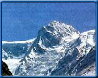
Bandarpunch
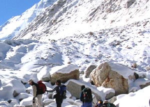
is an important glacier of Yamuna river basin . The glacier is 12kms. long situated
on the northern slopes of Bandarpunch peak(6316m) Bandarpunch west (6102m),
and Khatling peak (6387m). the glacier is formed by three cirque glacier and
later join the Yamuna river.The glacier lies on a gentle slope and is bounded
by lateral moraines, which indicate the last surface level of the glacier.
The glacier can be approached from Dehradun to Sankri-Saur by bus and from Sankri-Saur
to Taluka, 11kms. by jeep or light vehicle, then Osla, 14kms. From Osla Ruinsiara
Tal, located just below the glacier snout, is the best camping site. From Ruinsiara
one can visit the glacier and surrounding
area.
TREKKING : BASE CAMP TALUKA
• Taluka to Bandarpunch 23kms
• Taluka to Seema /Osla 14kms
• Seema to Bandarpunch 15kms
• Taluka to Mussoorie 171kms
• Mussoorie to Dehradun 36kms
By Road : Dehradun to Taluka 207kms
Gangotri Glacier
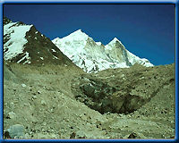
Gangotri
Glacier is a well-known glacier in Garhwal Himalaya, situated in Uttarkashi
district. The glacier roiginates at the northern slope of Chaukhamba range of
peaks. This is not a single valley glacier, but a combination of several other
glacier that are fed to it and form a huge mass of ice. Bhrigupanth (6772m),
Kirti stambh (6285), Sumeru Parvat (6380) respectively and Ratavana Bamak, Chaturangi
Bamak and Swachand Bamak lie on the northeast slope of Srikailash, Man parvat,
Satopanth and an un-named group of peaks. The glacier lies within a span of
28kms. and terminates at Gaumukh(4000m). The glacier flows at a gentle slope
except for a few ice walls and crevices developed in the upper regions of the
glacier where, as in the lower part (above the snout), the glacier is covered
by debris, which imparts a muddy appearance to its surface. The glacier is easily
approachable. It is well connected by motorable road upto Gangotri temple and
from there a 17kms, long bridle path follows along the right bank of the Bhagirathi
river to Gaumukh, the snout of the glacier.
TREK : BASE CAMP GANGOTRI GLACIER Gangotri temple to Gangotri Glacier
17kms.
By Road :
• Gangotri to Uttarkashi 99kms.
• Gangotri to Tehri 173kms.
• Tehri to Rishikesh 85kms.
Khatling Glacier
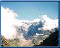
This
lateral glacier situated in Tehri district is the source of river Bhilangna.
The glacier is surrounded by snow peaks of the Jogin group (6466m), Sphetic
Pristwar (6905m), Barte Kauter (6579m) Kirti Stambh (6902m) and Meru. The moraines
on the side of the glaciers look like standing walls of gravel mud.
The trek which starts from Ghuttu is easily approachable by motor from Dehradun,
Tehri, Mussoorie and the Rishikesh railhead. One has to trek about 45kms.
and pass through remote villages with thick Kharsao forest and wide open beautiful
lush grassy meadows. The entry to the Bhilangna Valley provides excellent
spots for camping. Tents and adequate provisions need to be arranged in advance
from Rishikesh, Tehri and Dehradun.
TREK : BASE CAMP GHUTTU
• Ghuttu to Reeh 10kms.
• Reeh to Gangi 10kms.
• Gangi to Kalyani 5kms.
• Kalyani to Bhelbagi 13kms.
• Bhelbagi to Khatling 7kms .
By Road :
• Ghuttu to Tehri 64kms.
• Tehri to Rishikesh 83kms.
Doonagiri Glacier
Doonagiri glacier is one of the important glacier of Dhauli Ganga
system of glacier where more than 500 glacier, of different shapes and sizes
lie in the deep and narrow valleys. The important glacier here are: Changbang,
Girthi Hoti and Niti glaciers, Doonagiri glacier is 5.5kms. long, extending
between an elevation from it head 5150m to the snout 4240m, which is the terminal
point of the glacier. A stream originating from the glacier merges into Dhauli
Ganga near the Juma village.
The glacier is approachable from Juma on the way to Joshimath-Malari road.
8kms. from Juma lies the Doonagiri village. From Doonagiri village a 12kms.
long foot-trek runs along the Doonagiri stream to reach the glacier snout.
Bagini is another glacier in this valley. Doonagiri is the last village in
the valley. Near the vicinity of the glacier there is a good place for camping.
The best time to visit the place is mid May to mid October.
TREK : BASE CAMP JUMA VILLAGE
• Juma to Doonagiri Glacier 20kms.
• Juma to Doonagiri Village 8kms.
• Doonagiri to Doonagiri Glacier 12kms.
By Road :
• Juma to Joshimath 43kms.
• Joshimath to Srinagar 147kms.
• Srinagar to Rishikesh 109kms.
Dokrani Glacier
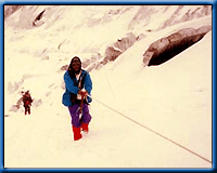
Dokriani
Bamak (Bamak is the local name of the glaciers) is another well developed medium-sized
glacier of the Bhagirathi basin. The glacier is formed by two cirques, originating
at the northern slope of Draupadi-ka-Danda and Jaonli peak, 5600m and 6000m
respectively. The glacier is 5 km. long and flows in the northwest direction
terminating at an elevation of 3800m. The stream originating from the glacier's
melted water is called Dingad which later joins many other snow / ice melted
streams and finally merges into Bhagirathi river near Bukki village. There are
several well- developed meadows and Proglacial lakes located 2kms. below the
snout of the glacier. These meadows, lakes and other formations themselves tell
us the past history and behavior of the glacier and also provide good camping
sites.The glacier is easily approachable from Uttarkashi. Nearly 56kms. from
Uttarkashi on the road to Gangotri, Bukki village is 2kms. from the bus terminus
situated on the right bank of Bhagirathi river. On way to Dokriani glacier,
one has to walk 23kms. from the road (Bukki village). After crossing the Bhagirathi
river a footpath flows along the steep mountain slopes up to Tela camp (2500m).
from tela to Gujjar hut a 12km. run along the Dingad stream is a route offered
to cross the several up and down ridges, many small and big streams and dense
mixed forests of Deodar, Rhododendron, Oak, Pine etc. provide an atmosphere
of perfect peace and tranquility. overwhelmed by such heart-touching beauty
one crosses the way without difficulties. Gujjar Hut ( a summer camp of Gujjars
with their buffaloes) is located at a height of 3500m., just 5kms. below the
Dokriani glacier. Gujjar Hut is the gateway of the valley. The valley has a
gentle slope with different land features formed by the glacier and surrounded
by snow-covered peaks. This place is good for camping and one can walk up to
the glacier and adjoining areas and climb the small peaks. Only Gujjar huts
and a base camp ( near the glacier snout ) of Wadia Institute of Himalayan Geology,
Dehradun lie on the way. One visiting the area has to make his own arrangement
for food, tents and light warm clothes. The best season to visit is throughout
summer and autumn . Besides the above two glaciers, Kedar, Rudugaira and Jaonli
are some other glaciers which are approachable by the same way
TREK : BASE CAMP NANITAL
• Bukki to Dokriani Glacier 23kms.
• Bukki to Bukki village 2kms.
• Bukki to kheratal 17kms.
• Kheratal to Dokriani Glacier 5kms
• Bukki to Uttarkashi 34kms
• Uttarkashi to Rishikesh 149kms
Kaphini Glacier
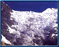
The
scenic beauty and the tranquility prevailing this region has an unbeatable charm.
The Kaphini Glacier lies left of the Pindar Valley below the famous peak of
Nandakot. The route to Kaphini Glacier covers the same track up to Dwali, as
the track to Pindari. Kaphini Glacier is 12 km from Dwali via Byali Udiyar,
which is at a distance of 8 km from Dwali. As compared to Pindar the valley
is much broader and the rhododendron (burans) that blooms here is spectacularly
beautiful. The main Himalayan summits visible from the glacier are Nandakot
(6860 m) and Nandabhnar (6236 m).
There are no rest houses beyond Dwali on the Kaphini track, so one has to
use tents. Byali Udiyar is an ideal spot for a night's stay, because there
are grasslands to pitch a tent and caves for a convenient night halt. To reach
the glacier, one should start very early from Byali Udiyar 4 km away, so as
to arrive at the zero point before 9 a.m..
Trek Base Camp Saung
• Saung to Kaphini Glacier 45 km.
• Saung to Loharkhet 3 km,
• Loharkhet to Dhakuri 11 km,
• Dhakuri to Khati 8 km,
• Khati to Dwali 11 km,
• Dwali to Kaphini Glacier 12 km.
By Road :
• Saung to Bageshwar 36 km.
• Saung to Almora 109 km.
• Saung to Kathgodam 199 km.
• Khati to Dwali 11 km,
• Dwali to Phurkia 7 km,
• Phurkia to Pindari Glacier 5 km.
Ralam Glacier
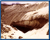
RalamGlacier
is situated in Tehsil Munsiyari of Pithoragarh district.The road head for ralam
glacier is Munsiyari. Munsiyari is 200km from Almora, 262 km from Nainital and
280km from Kathgodam. The Ralam glacier trek is a very tough and beautiful trek.
It is 50km trek from road head. The main attraction of this treks are ralam
and paton village, Damfu Bugyal and Ralam glacier. There are three glaciers
meet in ralam glacier (kalabaland, sutela and yangchar glaciers). The maximum
height of this trek is 3900m. Kalabaland is one of the beautiful glacier in
this valley. The best time to come here is last week of April to last week of
June and first week of September to first week of November. You must have 8-10
days for the trekking of Ralam glacier.
TOUR ENDS WITH SWEET MEMORIES TAKE HOME
Glaciers of Uttaranchal Reservation Form


 Bandarpunch
is an important glacier of Yamuna river basin . The glacier is 12kms. long situated
on the northern slopes of Bandarpunch peak(6316m) Bandarpunch west (6102m),
and Khatling peak (6387m). the glacier is formed by three cirque glacier and
later join the Yamuna river.The glacier lies on a gentle slope and is bounded
by lateral moraines, which indicate the last surface level of the glacier.
 Gangotri
Glacier is a well-known glacier in Garhwal Himalaya, situated in Uttarkashi
district. The glacier roiginates at the northern slope of Chaukhamba range of
peaks. This is not a single valley glacier, but a combination of several other
glacier that are fed to it and form a huge mass of ice. Bhrigupanth (6772m),
Kirti stambh (6285), Sumeru Parvat (6380) respectively and Ratavana Bamak, Chaturangi
Bamak and Swachand Bamak lie on the northeast slope of Srikailash, Man parvat,
Satopanth and an un-named group of peaks. The glacier lies within a span of
28kms. and terminates at Gaumukh(4000m). The glacier flows at a gentle slope
except for a few ice walls and crevices developed in the upper regions of the
glacier where, as in the lower part (above the snout), the glacier is covered
by debris, which imparts a muddy appearance to its surface. The glacier is easily
approachable. It is well connected by motorable road upto Gangotri temple and
from there a 17kms, long bridle path follows along the right bank of the Bhagirathi
river to Gaumukh, the snout of the glacier.
  This
lateral glacier situated in Tehri district is the source of river Bhilangna.
The glacier is surrounded by snow peaks of the Jogin group (6466m), Sphetic
Pristwar (6905m), Barte Kauter (6579m) Kirti Stambh (6902m) and Meru. The moraines
on the side of the glaciers look like standing walls of gravel mud.
 Dokriani
Bamak (Bamak is the local name of the glaciers) is another well developed medium-sized
glacier of the Bhagirathi basin. The glacier is formed by two cirques, originating
at the northern slope of Draupadi-ka-Danda and Jaonli peak, 5600m and 6000m
respectively. The glacier is 5 km. long and flows in the northwest direction
terminating at an elevation of 3800m. The stream originating from the glacier's
melted water is called Dingad which later joins many other snow / ice melted
streams and finally merges into Bhagirathi river near Bukki village. There are
several well- developed meadows and Proglacial lakes located 2kms. below the
snout of the glacier. These meadows, lakes and other formations themselves tell
us the past history and behavior of the glacier and also provide good camping
sites.The glacier is easily approachable from Uttarkashi. Nearly 56kms. from
Uttarkashi on the road to Gangotri, Bukki village is 2kms. from the bus terminus
situated on the right bank of Bhagirathi river. On way to Dokriani glacier,
one has to walk 23kms. from the road (Bukki village). After crossing the Bhagirathi
river a footpath flows along the steep mountain slopes up to Tela camp (2500m).
from tela to Gujjar hut a 12km. run along the Dingad stream is a route offered
to cross the several up and down ridges, many small and big streams and dense
mixed forests of Deodar, Rhododendron, Oak, Pine etc. provide an atmosphere
of perfect peace and tranquility. overwhelmed by such heart-touching beauty
one crosses the way without difficulties. Gujjar Hut ( a summer camp of Gujjars
with their buffaloes) is located at a height of 3500m., just 5kms. below the
Dokriani glacier. Gujjar Hut is the gateway of the valley. The valley has a
gentle slope with different land features formed by the glacier and surrounded
by snow-covered peaks. This place is good for camping and one can walk up to
the glacier and adjoining areas and climb the small peaks. Only Gujjar huts
and a base camp ( near the glacier snout ) of Wadia Institute of Himalayan Geology,
Dehradun lie on the way. One visiting the area has to make his own arrangement
for food, tents and light warm clothes. The best season to visit is throughout
summer and autumn . Besides the above two glaciers, Kedar, Rudugaira and Jaonli
are some other glaciers which are approachable by the same way
Dokriani
Bamak (Bamak is the local name of the glaciers) is another well developed medium-sized
glacier of the Bhagirathi basin. The glacier is formed by two cirques, originating
at the northern slope of Draupadi-ka-Danda and Jaonli peak, 5600m and 6000m
respectively. The glacier is 5 km. long and flows in the northwest direction
terminating at an elevation of 3800m. The stream originating from the glacier's
melted water is called Dingad which later joins many other snow / ice melted
streams and finally merges into Bhagirathi river near Bukki village. There are
several well- developed meadows and Proglacial lakes located 2kms. below the
snout of the glacier. These meadows, lakes and other formations themselves tell
us the past history and behavior of the glacier and also provide good camping
sites.The glacier is easily approachable from Uttarkashi. Nearly 56kms. from
Uttarkashi on the road to Gangotri, Bukki village is 2kms. from the bus terminus
situated on the right bank of Bhagirathi river. On way to Dokriani glacier,
one has to walk 23kms. from the road (Bukki village). After crossing the Bhagirathi
river a footpath flows along the steep mountain slopes up to Tela camp (2500m).
from tela to Gujjar hut a 12km. run along the Dingad stream is a route offered
to cross the several up and down ridges, many small and big streams and dense
mixed forests of Deodar, Rhododendron, Oak, Pine etc. provide an atmosphere
of perfect peace and tranquility. overwhelmed by such heart-touching beauty
one crosses the way without difficulties. Gujjar Hut ( a summer camp of Gujjars
with their buffaloes) is located at a height of 3500m., just 5kms. below the
Dokriani glacier. Gujjar Hut is the gateway of the valley. The valley has a
gentle slope with different land features formed by the glacier and surrounded
by snow-covered peaks. This place is good for camping and one can walk up to
the glacier and adjoining areas and climb the small peaks. Only Gujjar huts
and a base camp ( near the glacier snout ) of Wadia Institute of Himalayan Geology,
Dehradun lie on the way. One visiting the area has to make his own arrangement
for food, tents and light warm clothes. The best season to visit is throughout
summer and autumn . Besides the above two glaciers, Kedar, Rudugaira and Jaonli
are some other glaciers which are approachable by the same way  The
scenic beauty and the tranquility prevailing this region has an unbeatable charm.
The Kaphini Glacier lies left of the Pindar Valley below the famous peak of
Nandakot. The route to Kaphini Glacier covers the same track up to Dwali, as
the track to Pindari. Kaphini Glacier is 12 km from Dwali via Byali Udiyar,
which is at a distance of 8 km from Dwali. As compared to Pindar the valley
is much broader and the rhododendron (burans) that blooms here is spectacularly
beautiful. The main Himalayan summits visible from the glacier are Nandakot
(6860 m) and Nandabhnar (6236 m).
The
scenic beauty and the tranquility prevailing this region has an unbeatable charm.
The Kaphini Glacier lies left of the Pindar Valley below the famous peak of
Nandakot. The route to Kaphini Glacier covers the same track up to Dwali, as
the track to Pindari. Kaphini Glacier is 12 km from Dwali via Byali Udiyar,
which is at a distance of 8 km from Dwali. As compared to Pindar the valley
is much broader and the rhododendron (burans) that blooms here is spectacularly
beautiful. The main Himalayan summits visible from the glacier are Nandakot
(6860 m) and Nandabhnar (6236 m). RalamGlacier
is situated in Tehsil Munsiyari of Pithoragarh district.The road head for ralam
glacier is Munsiyari. Munsiyari is 200km from Almora, 262 km from Nainital and
280km from Kathgodam. The Ralam glacier trek is a very tough and beautiful trek.
It is 50km trek from road head. The main attraction of this treks are ralam
and paton village, Damfu Bugyal and Ralam glacier. There are three glaciers
meet in ralam glacier (kalabaland, sutela and yangchar glaciers). The maximum
height of this trek is 3900m. Kalabaland is one of the beautiful glacier in
this valley. The best time to come here is last week of April to last week of
June and first week of September to first week of November. You must have 8-10
days for the trekking of Ralam glacier.